
Garmin TOPO Lite AU and NZ - MicroSD V6
Topographic Maps for Australia & New Zealand
Topographic Maps for Australia & New Zealand
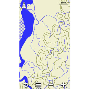
at 40 m intervals.
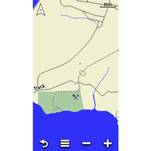
Includes 40m contours, and non-routable road content from HERE (navteq) maps for all of Australia, New Zealand, Lord Howe Island, Three Kings Islands, Snares Islands, Auckland Islands, Stewart Island, Campbell Island, Kermadec Islands, Chatnam Islands, Bounty Islands, and Antipodes Island. This map provides a wide array of topographic information from terrain contours, elevations and summits to coverage of perennial and intermittent lakes, rivers and streams in Australia and New Zealand. Includes built-in DEM data with 3-D shading and route elevation profiles on compatible devices so you can estimate terrain difficulty.
Latest version released April 2018.
Contains more than 105,000 km of Tracks, Roads & Outback Trails
As well as searchable points of interest.
Would you like the road and street detail shown on in-car navigators (but without the routing capability) displayed on your battery powered hand-held? With this product you get that, PLUS more tracks, roads and outback trails; also displays 4WD destinations and hydrographic features: lake/river shorelines and perennial and seasonal streams.
Shows national, state and local parks as well as parks and reserve areas.