


Garmin Overlander
Roam the Unknown with the Rugged, All-terrain Navigator Built for On- and Off-road Navigation
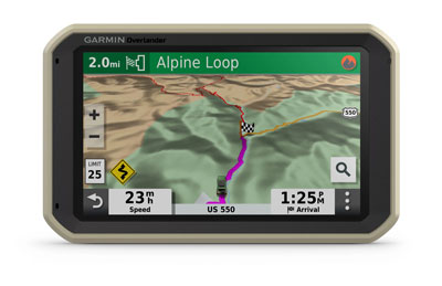
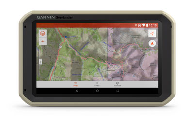
Built for every part of the journey, Overlander is a rugged, all-terrain navigator that can easily switch from turn-by-turn directions (HERE Maps) for on-road navigation to topography maps (HEMA 1:150k Raster) for off-grid guidance in Australia and New Zealand.
An essential device to include with your overlanding gear, the Overlander features integrated pitch and roll angles as well as a compass, altimeter and barometer to help you and your vehicle navigate difficult terrain. A built-in rechargeable battery means you can even take it beyond your vehicle.
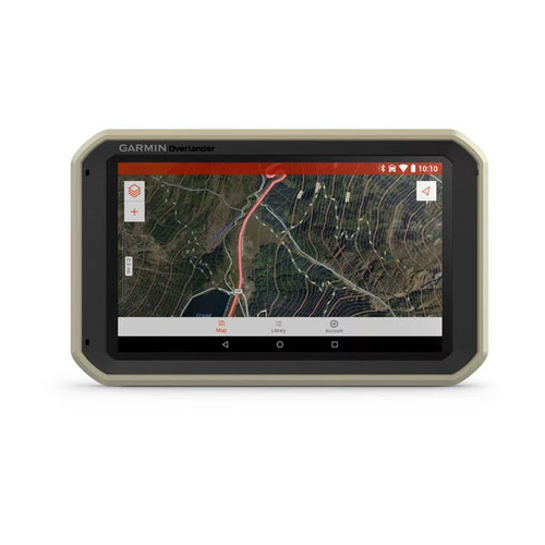
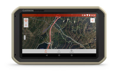
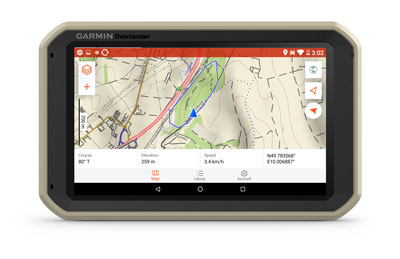
Create a Garmin Explore™ account to plan and map out your next adventure. You can easily record and create routes by tapping the screen on your Overlander navigator. Use your account to wirelessly sync — via Wi-Fi® connectivity1 — your tracks, routes and waypoints across all your devices.
On/Off Road
7" colour touchscreen features turn-by-turn directions for on-road navigation and Hema raster (1:150k) topography maps for off-road guidance covering Australia and New Zealand.
Garmin Explore
Use the Garmin Explore app to download additional maps on 64 GB of storage, and sync all of your data between devices1.
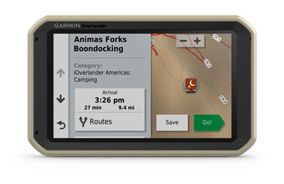
Find Campsites
Preloaded with iOverlander™ points of interest (POIs) and Ultimate Public Campgrounds, so you don’t need a cell signal to find the best-established, wild and dispersed campsites.
Find Boundaries
Features topographic maps with public land boundaries and 4x4 roads.
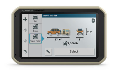
Know Your Vehicle
Customised street navigation for the size and weight of your truck, plus alerts for upcoming bridge heights, weight limits, sharp curves, steep grades and more.
RAM Mounted
Can be mounted anywhere with a powered magnetic mount that comes with a suction cup or RAM-compatible adapter.
InReach Compatible
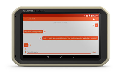
Pairs with inReach satellite communicators2 (sold separately) for two-way text messaging, interactive SOS and weather forecasts. inReach is a smart addition to your overlanding equipment.
Multi-GNSS Support
GPS, GLONASS and Galileo support helps track in more challenging environments than GPS alone.
1 Requires an active Wi-Fi connection
2 Active satellite subscription required for inReach device
General
| Physical Dimensions | 7.84" W x 4.79" H x 0.93" D (19.9 x 12.2 x 2.4 cm) |
| Display Size | 6.0" W x 3.5" H (15.2 x 8.9 cm); 6.95" (17.7 cm) |
| Display Resolution | 1024 x 600 |
| Display Type | multi-touch, glass, WSVGA color TFT with white backlight |
| Weight | 15.4 oz (437 g) |
| Battery | rechargeable lithium-ion |
| Battery life | up to 3 hours |
| Drop rating | MIL-STD-810 |
| Dust rating | IP5X |
| Magnetic Mount | |
| AMPS plate RAM ball adapter |
Maps & Memory
| Preloaded street maps | (HERE Maps with Updates) |
| 3D terrain | |
| Topo Maps | (HEMA Raster 1:150k) |
| Includes map updates | (HERE Street Maps Only) |
| Internal Storage | 64 GB |
| Data cards | Accepts microSD™ card (not included) |
Sensors
| GPS | |
| GLONASS | |
| Galileo | |
| Barometric altimeter | |
| Compass |
Outdoor Recreation Features
| Preloaded topographical maps | (HEMA Raster 1:150k) |
Navigation Features
| Garmin Real Directions™ landmark guidance | |
| Millions of Foursquare® points of interest | |
| TripAdvisor® ratings for points of interest | |
| Route shaping through preferred cities/streets | |
| Voice-activated navigation (operate device with spoken commands) | |
| Includes traffic | Yes (includes GTM36 Traffic receiver cable) |
| Lane assist with junction view (displays junction signs) | |
| Bluetooth® calling | |
| Driver alerts for sharp curves, school zones, red light and speed camera warnings and more |
Advanced Features
| Wi-Fi® map and software updates |
RV Features
| Specialized RV routing | |
| RV Parks and Services directory | |
| Road elevations | |
| Speed limit changes | |
| State border notices - RV | |
| Sunrise/sunset times - RV | |
| Mile marker info - RV |
Overlanding Features
| Pair with compatible inReach® devices | |
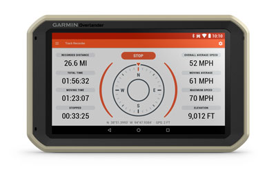
| Track recorder (breadcrumbs) | |
| Compatible with Garmin Explore® for waypoints, tracks, route and activities | |
| iOverlander™ points of interest | |
| Ultimate Public Campgrounds | |
| Pitch and Roll gauges |
In The Box
- Overlander
- Vehicle suction cup mount
- GTM36 Traffic receiver cable
- RAM ball adapter with AMPS plate
- Vehicle power cable
- USB cable
- Documentation