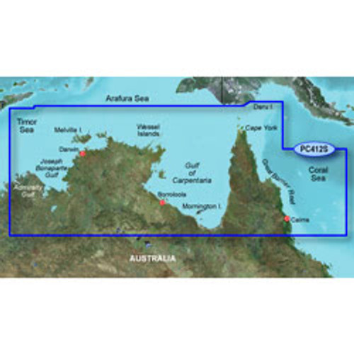


Garmin BlueChart® g3 - Admiralty Gulf to Cairns
- Provides industry-leading coverage, clarity and detail with updated coastal charts that feature integrated Garmin and Navionics® data
- Auto Guidance1 technology calculates a route using your desired depth and overhead clearance and provides a suggested path to follow
- Includes Depth Range Shading for up to 10 depth ranges, enabling you to view your target depth at a glance
- Up to 1’ contours provide a more accurate depiction of the bottom structure for improved fishing charts and navigation in swamps, canals and marinas
- NOAA raster cartography is available as a free downloadable feature via the ActiveCaptain® app
BlueChart g3 coastal charts provide industry-leading coverage, clarity and detail with integrated Garmin and Navionics data. Also included is Auto Guidance1 technology, which uses your desired depth and overhead clearance to calculate routes and provide a suggested path to follow — overlaid onto your chart. NOAA raster cartography is also available as a free downloadable feature via the ActiveCaptain app. It gives your chartplotter paper chartlike views of NOAA-surveyed areas in which individual points of interest are labeled with corresponding longitude and latitude information. Worldwide coverage is available by regions as accessory cards or via download; each region is sold separately.
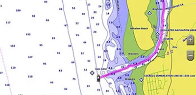
Auto Guidance Technology
The Auto Guidance feature1 calculates a suggested route using your desired depth and overhead clearance.
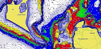
Depth Range Shading
The Auto Guidance feature1 calculates a suggested route using your desired depth and overhead clearance.
Shallow Water Shading
The Auto Guidance feature1 calculates a suggested route using your desired depth and overhead clearance.
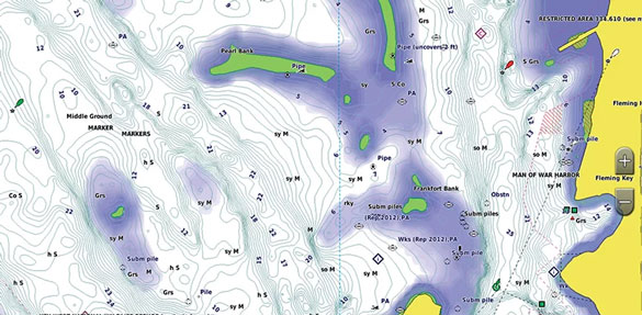
Detailed Contours
BlueChart g3 charts feature 1’ contours that provide a more accurate depiction of bottom structure for improved fishing charts and enhanced detail in swamps, canals and port plans.
NOAA Raster Cartography
This feature gives your chartplotter paper chartlike views of NOAA-surveyed areas in which points of interest are labeled with corresponding longitude and latitude information.
BlueChart g3 vs BlueChart g3 Vision
| Features | BlueChart g3 | BlueChart g3 Vision | |
|---|---|---|---|
| Integrated Garmin and Navionics content | |||
| Auto Guidance technology1 | |||
| Depth range shading | |||
| Up to 1' contours | |||
| Shallow water shading | |||
| Raster cartography2 | |||
| High-resolution relief shading | |||
| 3D chart views | |||
| High-resolution satellite imagery | |||
| Aerial photos | |||
1Auto Guidance is for planning purposes only and does not replace safe navigation practices. Auto Guidance is not included in preloaded BlueChart g3 for ECHOMAP™ Plus series chartplotters
2Raster cartography cannot be viewed on echoMAP devices but can be viewed on mobile devices via the ActiveCaptain mobile app.