-

-

-

-
ON SALE - SAVE $50.00 OFF RRP

-

-


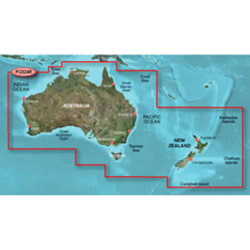
Garmin BlueChart g3 MicroSD Australia and New Zealand
010-C1020-20In Stock - Ships Today for Free!$229.00 -

-

-

-

-

-

Get more out of your GPS with the addition of specialised GPS maps.
GPS maps can cover a range of specific use cases, such as devoted marine mapping for ocean adventures and more comprehensive topographic mapping to formulate better hiking trails or to simply navigate a less charted area with greater ease.
Whether you're a passionate hiker, love fishing, spend your weekends trying out new 4WD trails or need more detailed mapping solutions for your work, the GPS maps at Johnny Appleseed GPS are sure to cater to your needs.
View the range and learn more about the benefits of using GPS maps below.
Types of GPS Maps Available
There are many types of GPS maps to choose from at Johnny Appleseed GPS, and a sizeable chunk are compatible with a range of Garmin devices.
These maps can include:
- Comprehensive trail information for off-road 4WD adventures.
- Marine charts for various sections of the ocean around Australia.
- Topographical maps of popular and lesser-known hiking and BMX trails throughout the country.
- In-depth route suggestions for road trips based on vehicle type, overhead clearance and depths of water you can drive through - applicable to 4WDs and other off-road capable vehicles.
How to Choose the Right GPS Map for Your Device
Many of the GPS maps available are compatible with Garmin GPS units.
When considering the specific GPS maps you’re interested in, go to the product page for each one to see which Garmin GPS units they’re compatible with.
If no specific unit is listed but it states Garmin compatibility, this means the GPS map card can be installed into any Garmin GPS unit with a microSD reader. In the event a GPS map is not designed for Garmin devices, this will be noted on the product page.
Most GPS maps are easy to add to your Garmin device by simply inserting the microSD containing the mapping data into your Garmin’s microSD card slot. It will seamlessly load in and then be useable from there.
If you ever have any issues with a GPS map card, you can reach out to our team and we can help navigate you through the installation process.
Benefits of Using Updated GPS Maps
A key benefit for many of these specialised GPS maps is that they’ll often include more frequent updates than the standard GPS you’ll get on a smartphone or vehicle’s OEM GPS.
Along with a typically healthy cadence of ongoing updates, specialised GPS maps can be better at providing up-to-date information on current happenings within the mapped region.
For example, a specialised marine GPS map may provide more current updates on weather, water conditions (winds, wave size, ocean currents, tides, etc.), ideal fishing spots for the day, and disruptions caused by local events such as approaching or departing cargo ships.
FAQs About GPS Maps
GPS maps are generally highly detailed maps of specific locations that offer more comprehensive details than the general mapping you’d get in a standard GPS.
These fleshed-out maps and accompanying data can include valuable information for specific use cases such as:
- Detailed topographical maps of hiking trails or mountain passages for hikers and off-track adventurers
- Marine charts with ocean depth, sea life, and underwater hazards or objects drawn from sonar readings
- Trail suggestions and natural landmark reference points for people taking on some offroad 4WD
- Important detailed mapping information for specific areas that aren’t as extensively documented by standard GPS (e.g. sections of country or outback where you need to account for cattle stock routes, airfields, farming property boundaries, etc.)
These comprehensive GPS maps can be loaded into compatible GPS units (such as Garmin) through the use of microSDs and other expandable storage to enhance the capabilities of standard GPS.
A devoted GPS map can provide a whole range of information that provides comprehensive insights into a specific area that you want or need to navigate.
Whereas paper maps can only provide a static representation of a specific region, GPS maps can be regularly updated to match changes in the region (new trails, roads, hazards, weather conditions, flooding, etc.).
This is also matched with general live information on a day-to-day basis - traffic conditions, minute-to-minute relevant weather data, current trail closures, etc.
Finally, as with general GPS, a GPS map will be able to provide live location tracking, which helps save time on the back-and-forth of assessing where you are relative to a static map.
No, and this is important to remember.
While most of the GPS maps at Johnny Appleseed GPS are compatible with Garmin devices, not all are. For example, the range of TopoDude GPS maps works with Hema Navigator and other devices that have OziExplorer GPS software installed.
They do not, however, work with most Garmin devices, save for the Garmin/Android hybrid GPS unit the Garmin Monterra, which allows you to download third-party GPS software via Google’s Play Store.
Always double-check the compatibility information included on each GPS map’s product page before making a final purchase.


